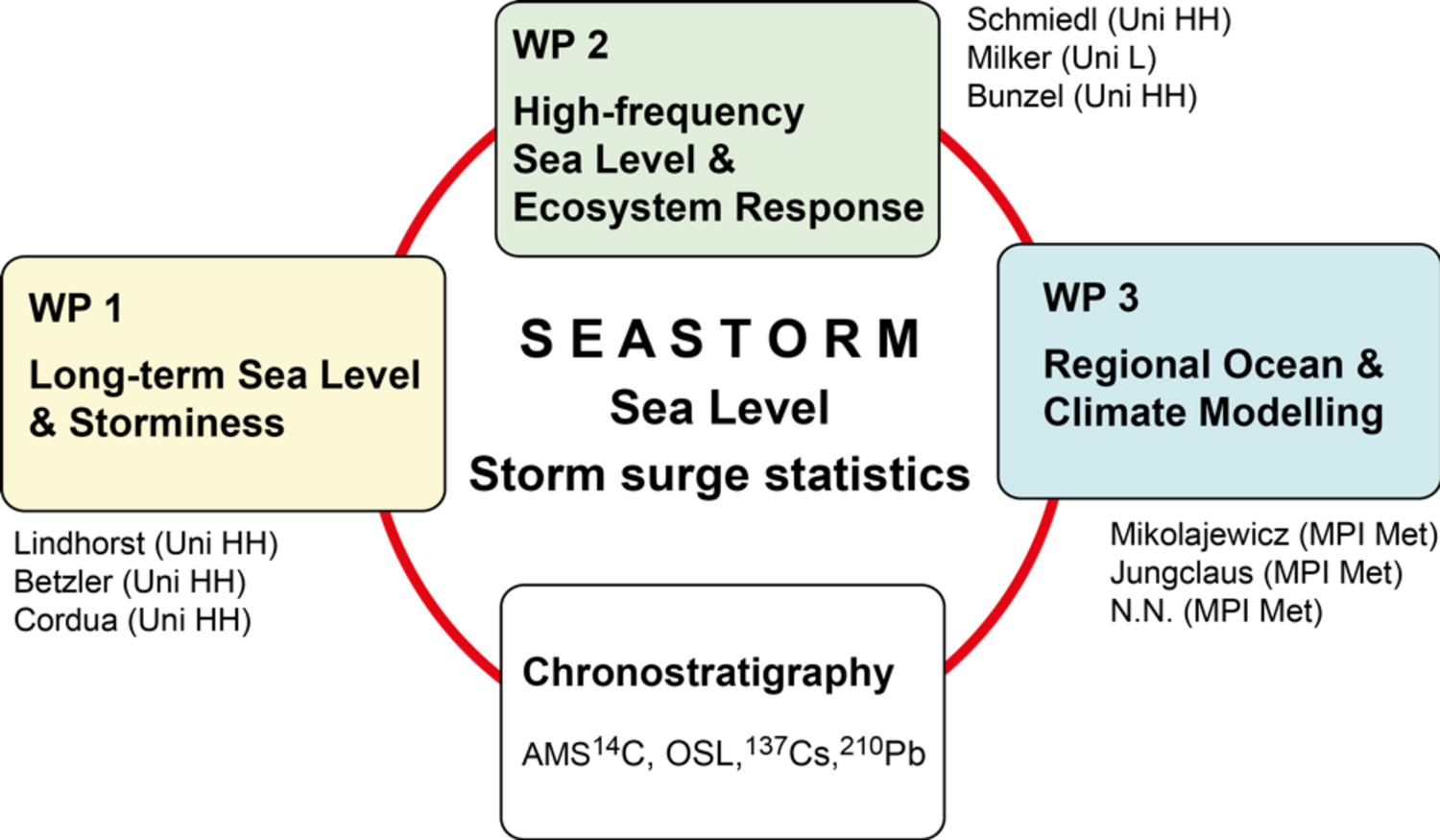
SEASTORM
Unraveling the signals of sea level and storminess of the past millennium (southern North Sea; SEASTORM)
Summary:
We propose to unravel the signals and impacts of local to regional sea level and storminess of the southern North Sea during the past millennium. The hypothesis to test is that existing proxy-based sea-level reconstructions bear a so far underestimated climate component. In order to address this hypothesis, we follow an integrated approach, combining proxy data from active salt marsh- and fossil polder-deposits obtained by geophysical, sedimentological and micropaleontological methods with results from regional climate model experiments. Specifically, we want to address the following objectives:
- Generation of data series of relative sea level and storminess of the past millennium at yearly to multi-decadal resolution,
- Evaluation of the impacts of shifts in local storm climate on proxy-based sea-level reconstructions,
- Investigation of the causes for decadal/multi-decadal variability of the sea level in the German Bight,
- Investigation of the variability in the probability density distribution of extreme storm-surge events in the German Bight and their relation to the climate variability in the North Atlantic realm,
- Investigation of the response of modern salt marsh environments to regional sea-level and climate change.
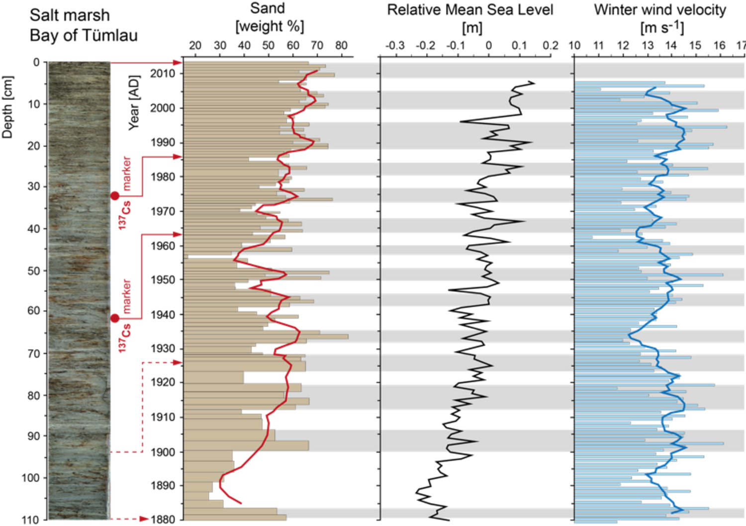
Both proxy and model approaches will focus on the same time intervals and key targets. Modern salt marsh sediments of the past 100 to 200 years will be sampled at erosion faces along gradients in tidal range and salinity of the North Frisian coast. Fossil marsh sediments of the past millennium will be surveyed and drilled from medieval to early modern polders. Detailed sedimentological data will allow for the reconstruction of depositional environments, relative sea level position and storm-surge frequency. The application of a foraminiferal transfer function will deliver accurate information on relative elevation changes with respect to the tidal frame. Proxy studies will be complemented by regional climate model experiments investigating climate variability and storm frequency of the North Sea for selected time intervals. The boundary conditions to drive the regional model will be obtained from simulations over the last millennium that were carried out with a global climate model in the framework of the Paleo Model Intercomparison Project. The regional model data will be used to study decadal variations of both sea level in the German Bight as well as large-scale climate variations leading to periods with intensified storm surge activity. Our project will provide the first attempt to reconstruct the forcing mechanisms and coastal impacts of sea-level variability and storminess of the southern North Sea on yearly to multi-decadal resolution by directly combining proxy data from various marsh sediment archives and climate modeling information.