CoRSEA
Coastal and Regional Sea Level Change and Subsidence - The Hazardous Potential in Indonesia and South East Asia (CoRSEA)
Climate change and fluctuations are a natural phenomenon and have occurred over different temporal scales during the Earth's history. Besides the natural variability, the question of human-induced changes of climate has gained increasing public awareness. Sea-level rise, which is widely recognized as one of the consequences of anthropogenic climate change, has a substantial social and economic impact. An aspect receiving increasing awareness is the hazardous potential of the combination of regional sea level rise and subsidence in highly populated coastal cities.
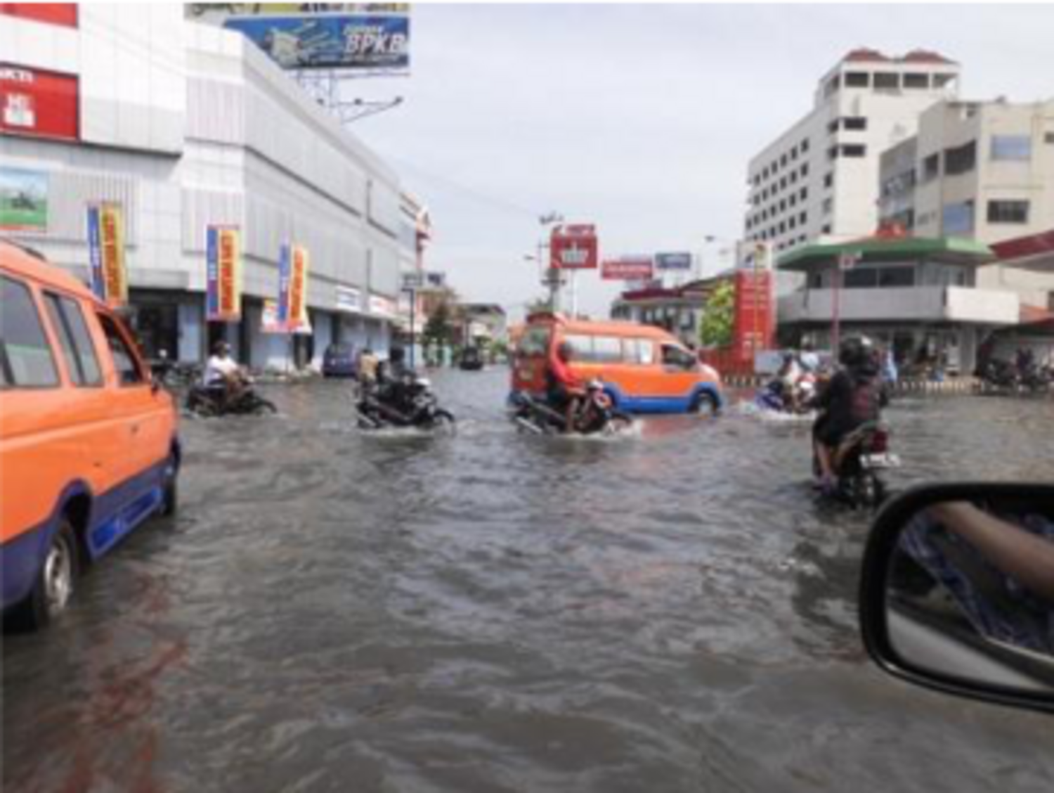
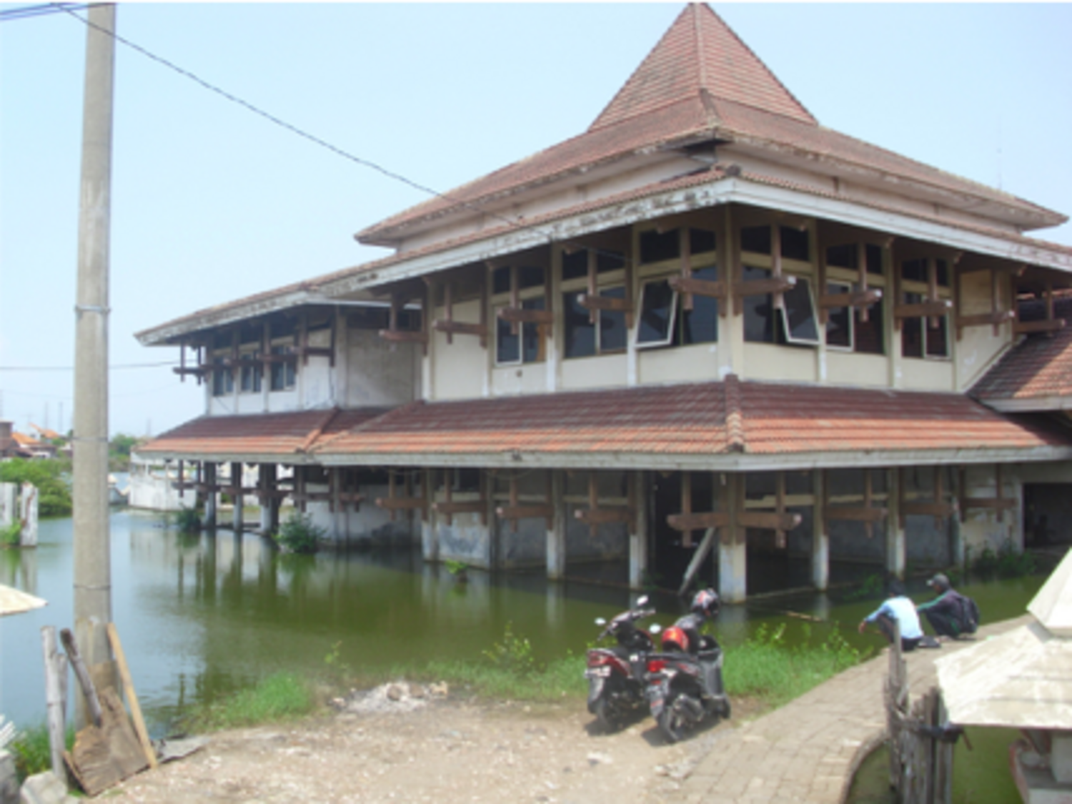
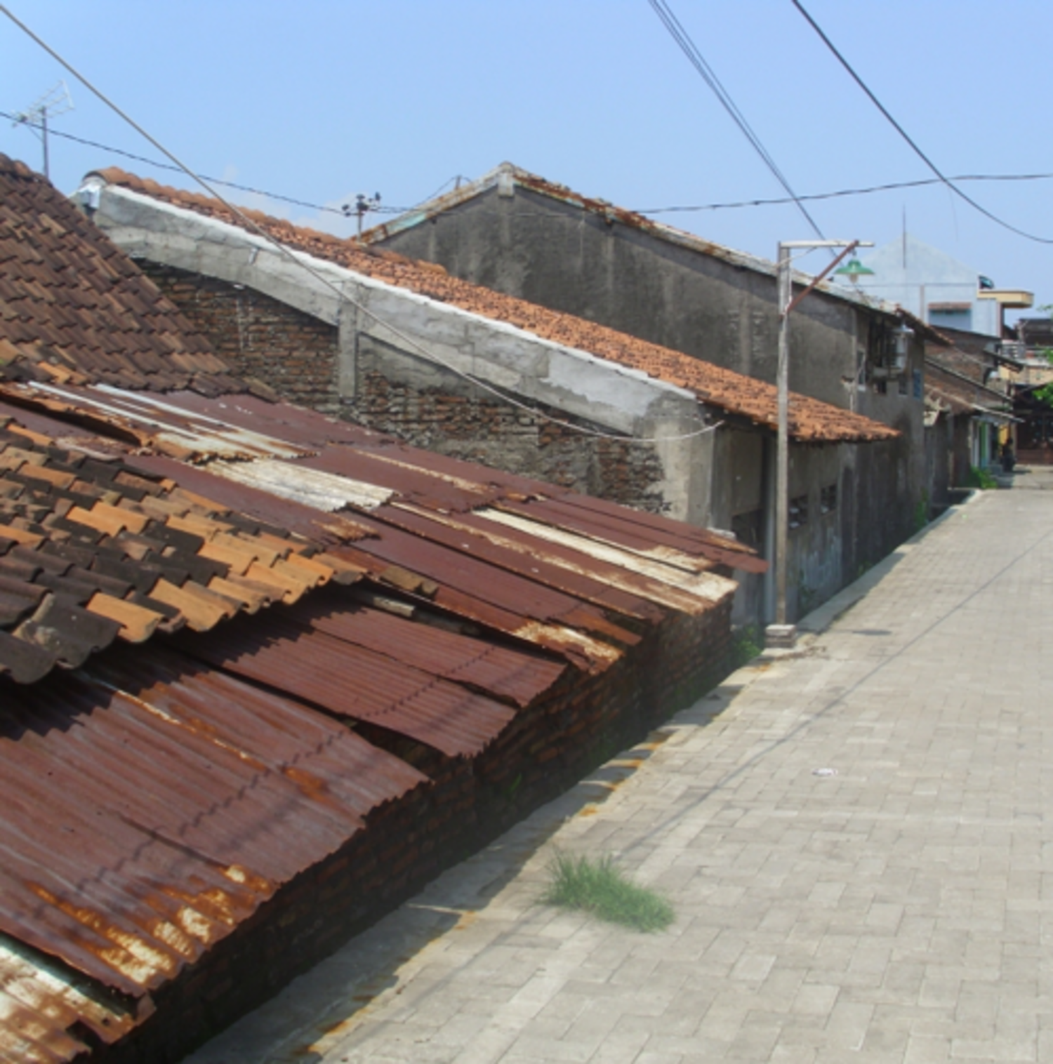
Approximately one third of the world’s population is now living within the coastal region or islands, and over two million square-kilometer of land are less than 1 meter above current sea level. Most of the largest South East Asian cities (e.g., Jakarta, Bangkok, Singapore, Ho Chi Minh City, Semarang, etc.) are located in coastal areas, and thus they are vulnerable to sea level rise. This situation will become worse for the regions suffering land subsidence due to tectonic instabilities, excessive groundwater withdrawal, increased surface load due to massive urban constructions and soil compaction in newly reclaimed land. Understanding global, regional and local sea level change and also its near-time projection is essential to coastal planning, land use planning, and economical development.
For the last two decades especially radar altimetry has played an important role in monitoring the sea level. Since the middle of the 80ties, several radar altimetry missions have acquired a substantial amount of sea level data; but even today these measurements from different missions do not lead to consistent sea level estimates. Depending on the choice of corrections algorithms distinctly different regional sea level trends are found. To overcome these deficiency different regional altimeter corrections shall be tested for their consistency and the regional sea level patterns will be analyzed.
The derivation of long-term trends is complicated by the fact, that climate-induced decadal and secular sea level changes can be concealed by seasonal, annual and interannual variations, which may act as noise masking long-term trends. Long-term time series of sea level measurements are available only from tide gauges, which are sensitive to vertical land movements and are, thus, records of relative rather than absolute sea level. In recent years, GNSS technology became increasingly important to correct tide gauges for changes in the vertical and GFZ operates GNSS-controlled tide gauges in Jakarta, Semarang, and Surabaya.
The accurate determination of the sea level in combination with subsidence estimates of Megacities and the challenge of combining different geodetic methods to predict near-future sea level changes in urban areas is of paramount importance for the societies.
This confronts us with the following tasks:
- Accurate determination of absolute sea level In South East Asia using multi-mission satellite altimetry of past, recent and upcoming missions supported by space and surface techniques from 1992 till today.
- Analysis of vertical rates of GNSS benchmarks at tide gauges in combination with tide gauge measurements to derive geocentric sea level change records with high resolution and long history,
- Improved estimates of historical global sea level variability by combining tide gauge measurements and radar altimetry.
We will work
- to use state-of-art geodetic sensors, including tide gauges, GNSS, Radar Altimetry, GRACE temporal gravity fields to quantify sea level changes, and the land subsidence respectively;
- to reconstruct/analyze sea level patterns especially for the coastal region in the area of Java/Indonesia with a focus to Jakarta, Semarang and Surabaya (this is extendable to other SE Asia cities or regions targeted within the SPP, e.g., Ho Chi Minh City, Bangkok, or West Papua).
- to study sea level changes, extreme sea level from tide gauge records and coastal flooding under the view of local subsidence
- to combine consolidated offshore and onshore sea level information with area information from other methods, like InSAR and ground water modeling, to provide background information for socio-economic assessments of past and recent sea level rise impacts.